
PUMPA - SMART LEARNING
எங்கள் ஆசிரியர்களுடன் 1-ஆன்-1 ஆலோசனை நேரத்தைப் பெறுங்கள். டாப்பர் ஆவதற்கு நாங்கள் பயிற்சி அளிப்போம்
Book Free DemoMadurai was formerly known as Madura. This city is situated in the South-central Tamil Nadu, Southern India. The ancient city of Madurai is more than \(2,500\) years old and was built by the Pandyan king Kulashekarar in the \(6^t\)\(^h\) - century \(BCE.\)
The reign of Nayakas marked as the Golden period of Madurai when art, architecture, and learning flourished expansively.
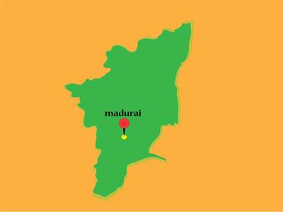
MADURAI pinned on a TAMIL NADU MAP
In ancient times Madurai was well known for its Tamil Sangam literature. A new Sangam was established in \(1901\). \(49\)poets were associated with the last Sangam age of Madurai. The fame of this ancient city reached its peak by the accounts of the Greek historian Megasthanese. Chanakya, a minister of Chandra Gupta Maurya, mentioned about Madurai in his work Arthasastra.
The antiquities yielded from Keezhadi and other sites says that Madurai was considered as the "Sangam valartha Nagaram".
Madurai was ruled by the Pandyas, the Cholas, the Kalabars and later by the Nayakas.
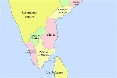
South India in AD 900.
Madurai is located on the banks of the Vaigai river, about \(30\) miles southeast of Dindigul. It is the third most populous and the oldest city in the state of Tamil Nadu.
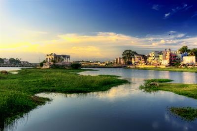
A sunrise over Vaigai River in Madurai, Tamil Nadu.
The Madurai region's ancient history is closely associated with the Pandya kings as it was the capital of the Pandya kingdom from \(4^t\)\(^h\) to \(11^t\)\(^h\) - century \(CE\). Later it was conquered by Cholas, Vijayanagar, Marathas, and the British. In the \(1940\ s\), it became the centre of the civil disobedience movement against the British raj, and it remained an important place for political leaders.
Agriculture was the primary occupation of the ancient Madurai people. The farmers knew different types of soil. This region was suitable for various irrigation systems.
According to Sangam literature, the Marutam region had the most fertile land to cultivate among the Tamil country's five divisions.
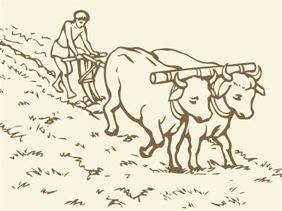
The land was classified, according to its fertility, as Menpulam (fertile land), Pinpulam (dry land), Vanpulam (hard land), and Kalarnilam or Uvarnilam (salty land). Menpulam yielded different types of crops. Pinpulam was cultivated only with dry crops due to limited irrigation facilities. The yield from Vanpulam was limited. Whereas, Kalarnilam was unfit for cultivation.
Reference:
1. Source: https://commons.wikimedia.org/wiki/File:South_India_in_AD_900.jpg
2. Source: https://www.flickr.com/photos/paulthy/
 Register for free to see more content