
PUMPA - SMART LEARNING
எங்கள் ஆசிரியர்களுடன் 1-ஆன்-1 ஆலோசனை நேரத்தைப் பெறுங்கள். டாப்பர் ஆவதற்கு நாங்கள் பயிற்சி அளிப்போம்
Book Free DemoPhysical maps
Natural features such as topography, geology, soils, drainage, weather, climate, and vegetation are all illustrated on physical maps. These can be classified into the following categories:
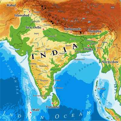
India - Physical Map
Relief Maps:
Relief maps depict the topography of a region, such as mountains and valleys, plains, plateaus, and drainage.
Geological maps:
Geological maps are made to depict geological features, rock types, and so on.
Climatic Maps:
Climatic Maps represent an area's climate areas. In addition, maps are created to depict temperature distribution.
Soil maps:
Soil maps are diagrams that depict the distribution of various types of soil and their characteristics.
Cultural Maps
These can be classified into the following categories:
Political Maps:
Political maps depict the administrative divisions of a region, such as a country, a state, or a district. These maps make it easier for the administrative machinery to plan the administrative unit in question.
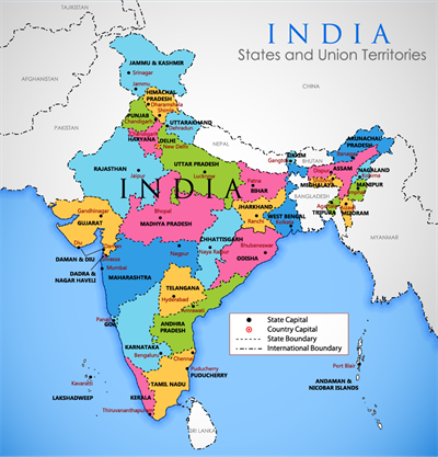
India - Political Map
Population Maps:
Population maps are used to depict population distribution, density, and growth, as well as age and gender composition, religious, linguistic, and social group distribution, and occupational structure.
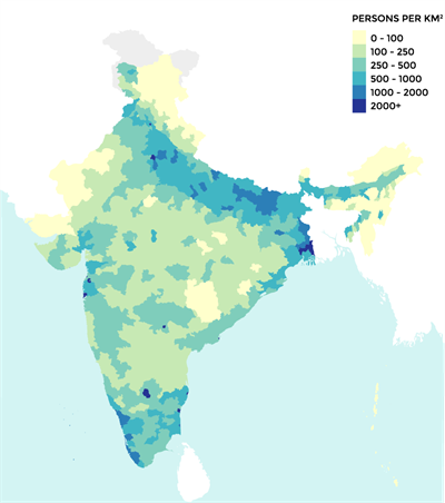
India - Population density map
Transportation Maps:
Roads, railway lines, and the locations of railway stations and airports are all included on these maps.
Indian Map showing Highways
Economic Maps:
Economic maps show the production and distribution of various crops and minerals, the location of industries and marketplaces, and trade and commodity flow routes.
Thematic maps:
These maps depict the spatial variation in the distribution of a specific feature or theme.
 Register for free to see more content